Unknown's avatar

A Village Called Mariolata

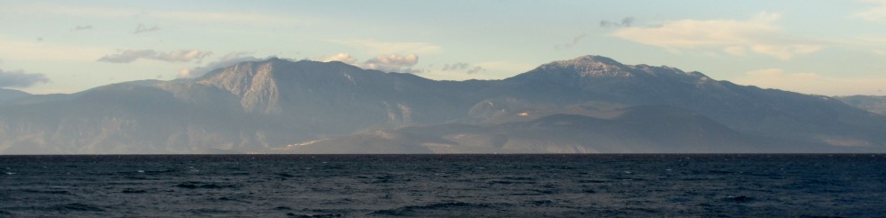
Last weekend we visited a little village on the northern slopes of Mt. Parnassos, thanks to a generous invitation from Sue’s cousin to stay at the house he’s built there.  Parnassos is the huge mountain we see to the north, looking straight off of our balcony in Sykia.  If you followed that line north, you’d arrive first at Delphi, then you’d cross the top ridge of Parnassos, and finally descend the other side to Mariolata, about 45 miles away.   Of course, the Gulf of Corinth is a big part of that 45 miles and, without a plane or an amphicar, it took us 3.5 hours to drive around the Gulf to his house.

Mariolata is on the floor of a high valley, about 400 meters above sea level, between Parnassos and Mt. Kallidromo to the north. If you continue north across the valley and cross over Mt. Kallidromo, you quickly arrive at Thermopylae, the site of the Spartans’ famous battle against the Persians in 480 BC.  (Geographically inclined readers will wonder how going north from Parnassos would take one to the shore of the Aegean, site of Thermopylae. The answer is that the Aegean shore takes a huge westward diversion at that spot, forming the Malian Gulf, the body of water at Thermopylae.)

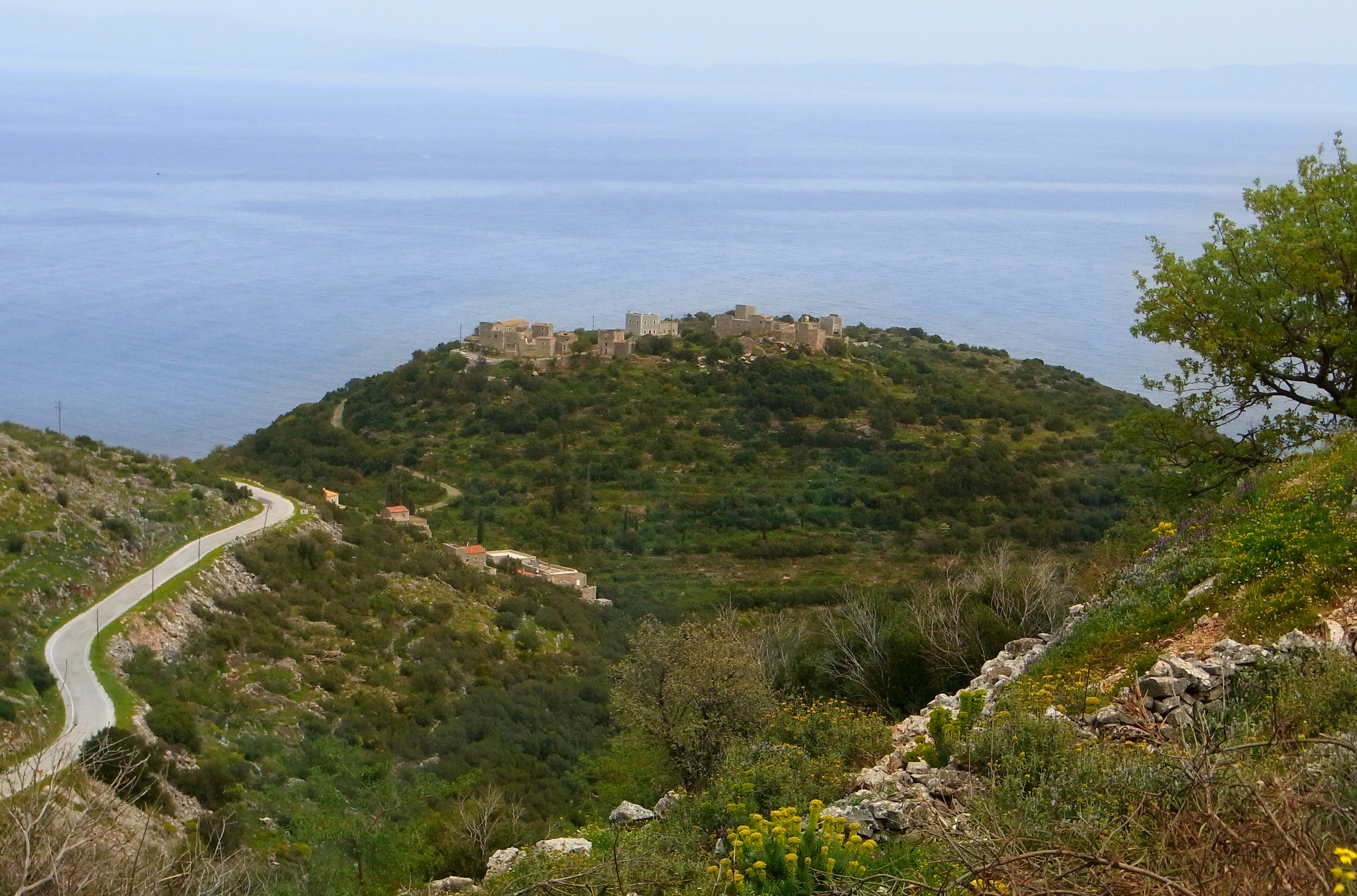
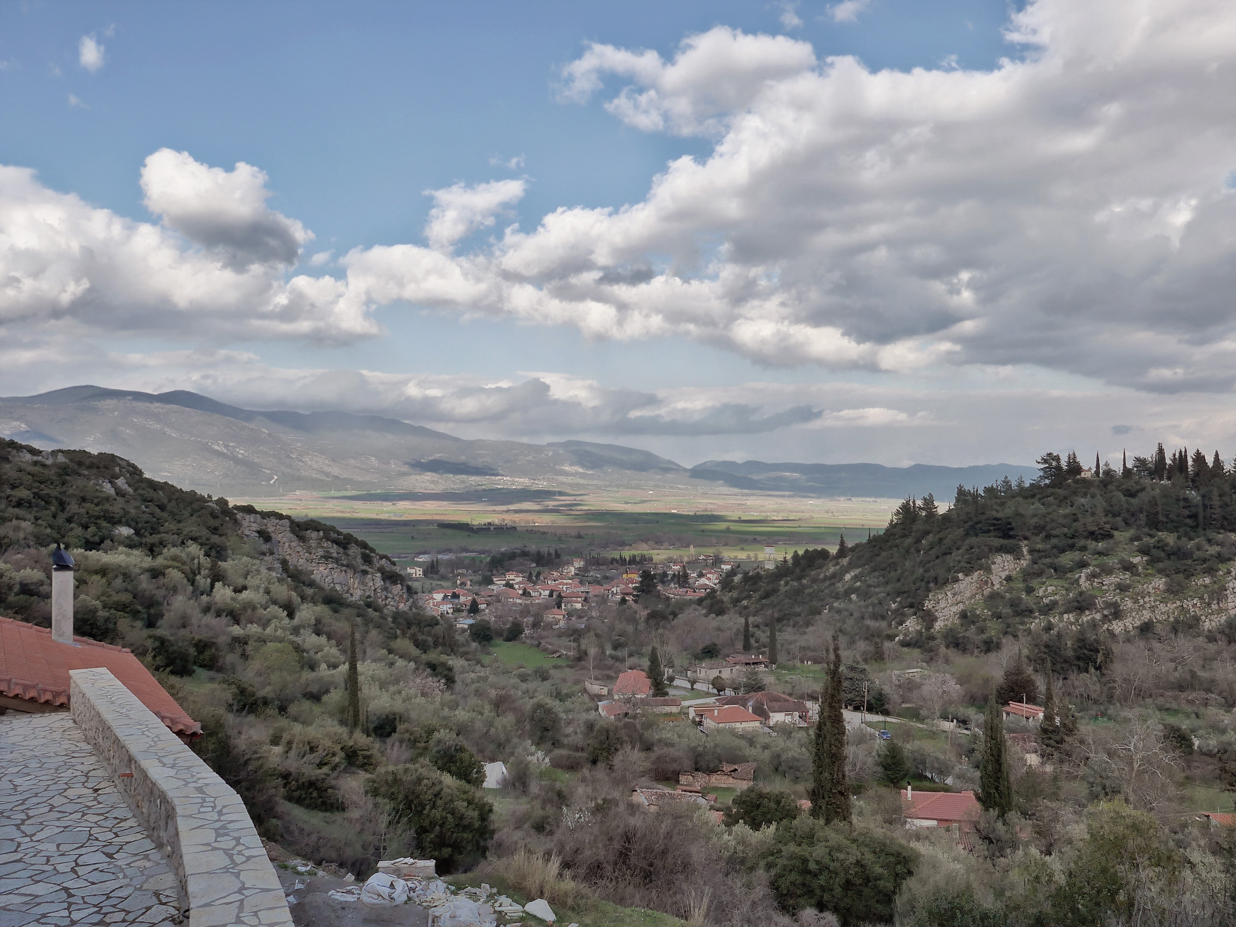
Sue’s cousin built in the upper part of the village, at about 500 meters, and enjoys this spectacular view of Mariolata, and across the Kifissos valley to Mt.  Kallidromo.

P1040123

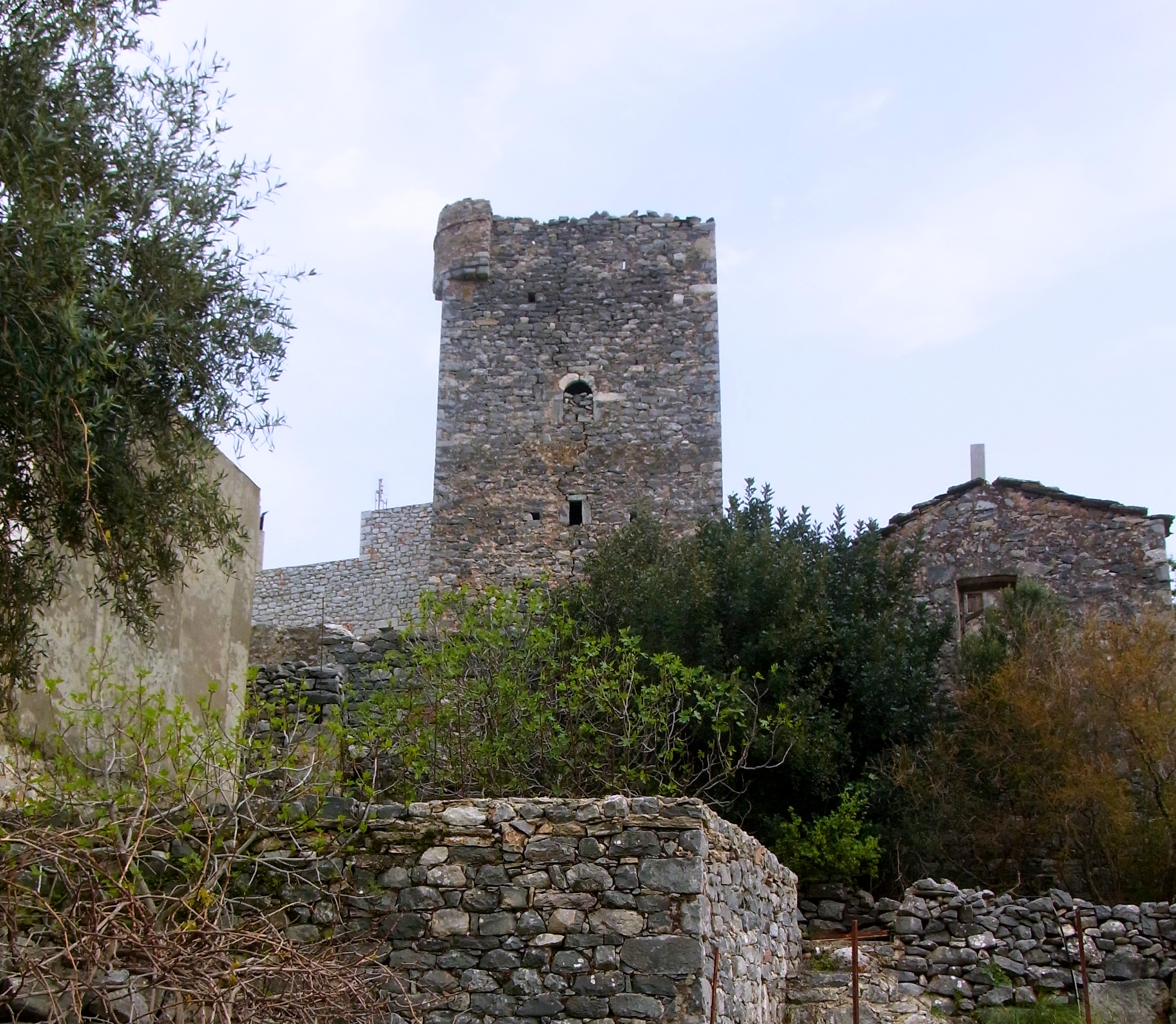
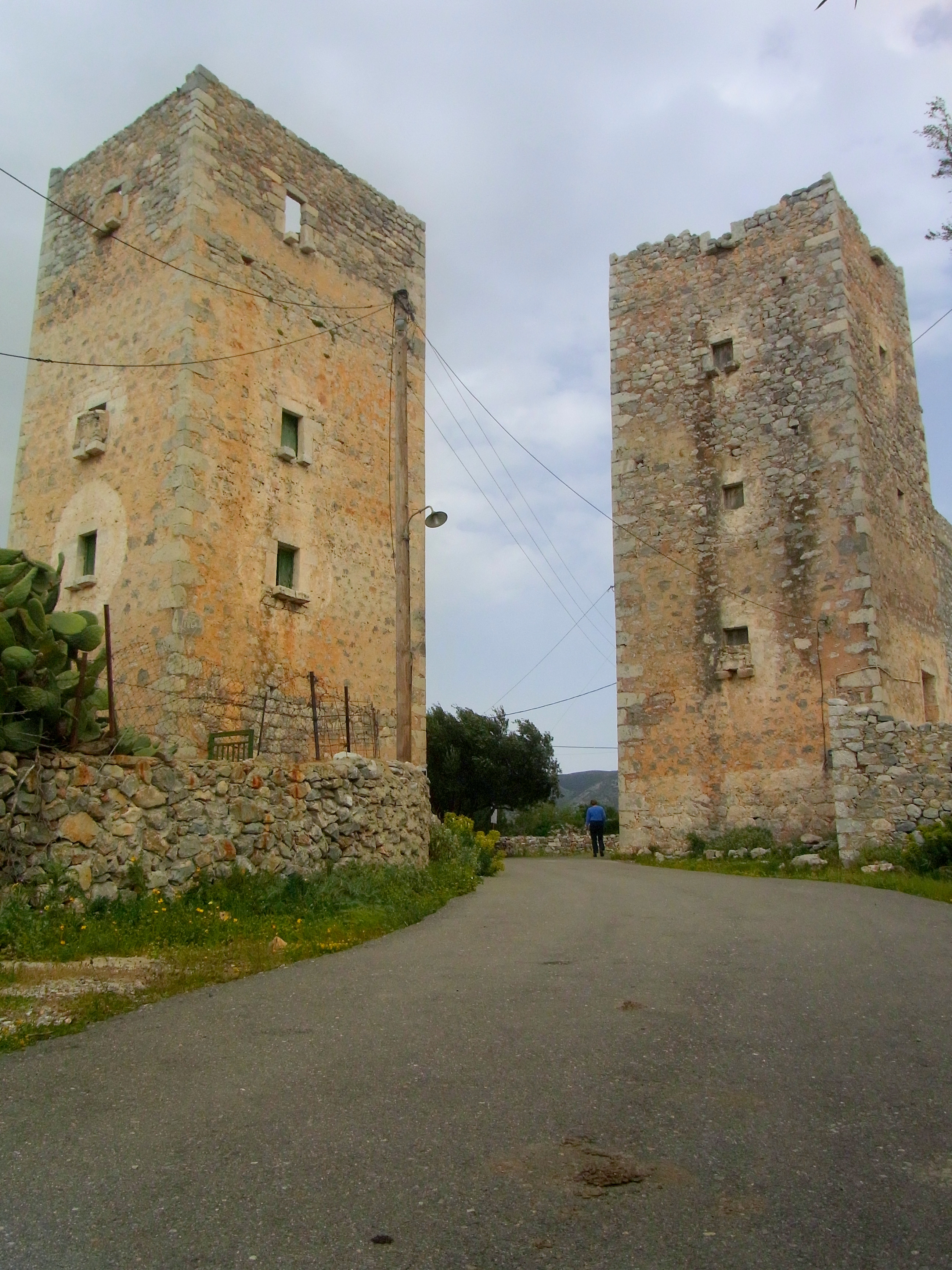
Mariolata traces its history back to ancient times and, after the Persians slaughtered the 300 Spartans at Thermopylae, it was one of the villages they destroyed on their way down to Athens.  Ancient ruins can be seen in the town today.

P1040129

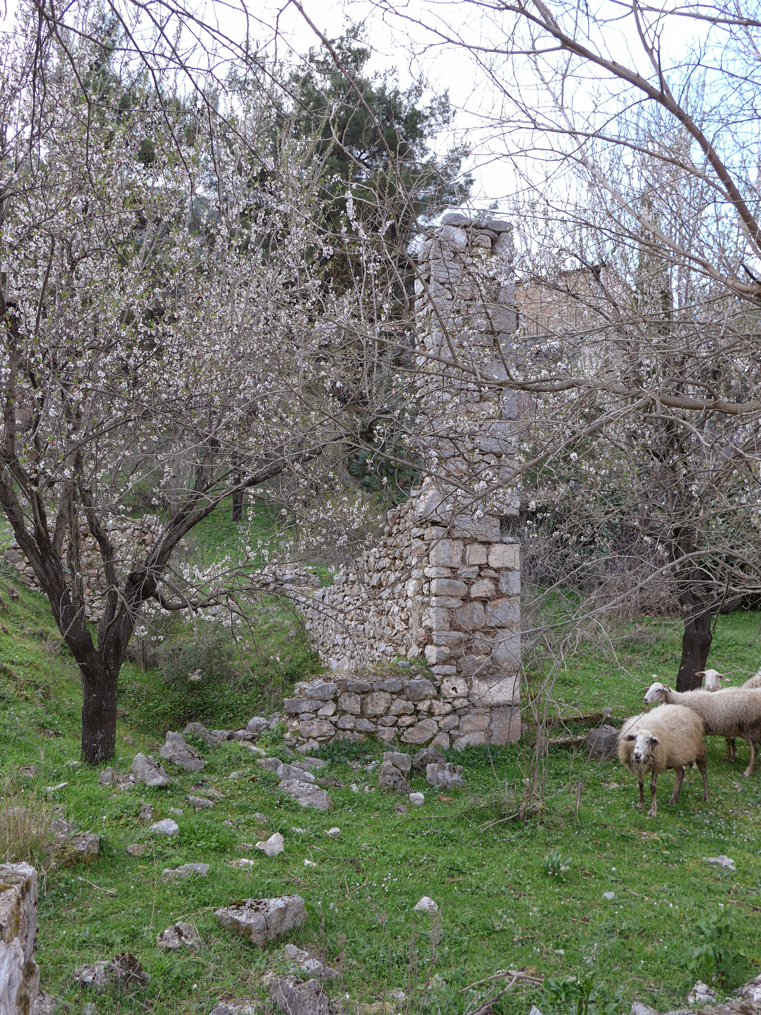
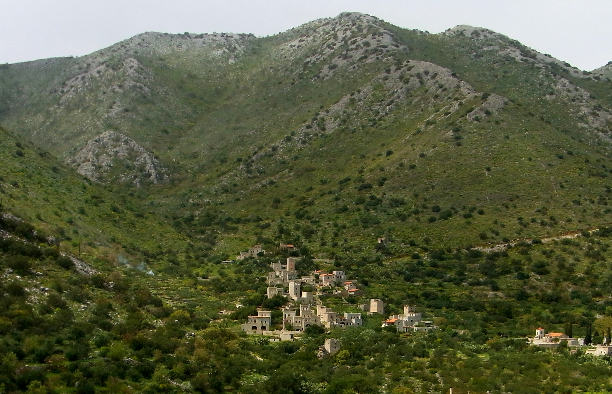
Until about 1960, Mariolata was sited up on the mountainside in a deep gorge served by a lovely mountain stream. That’s when Mother Nature  dealt Mariolata another savage blow, turning that stream into a raging torrent that destroyed the village again.

P1040137

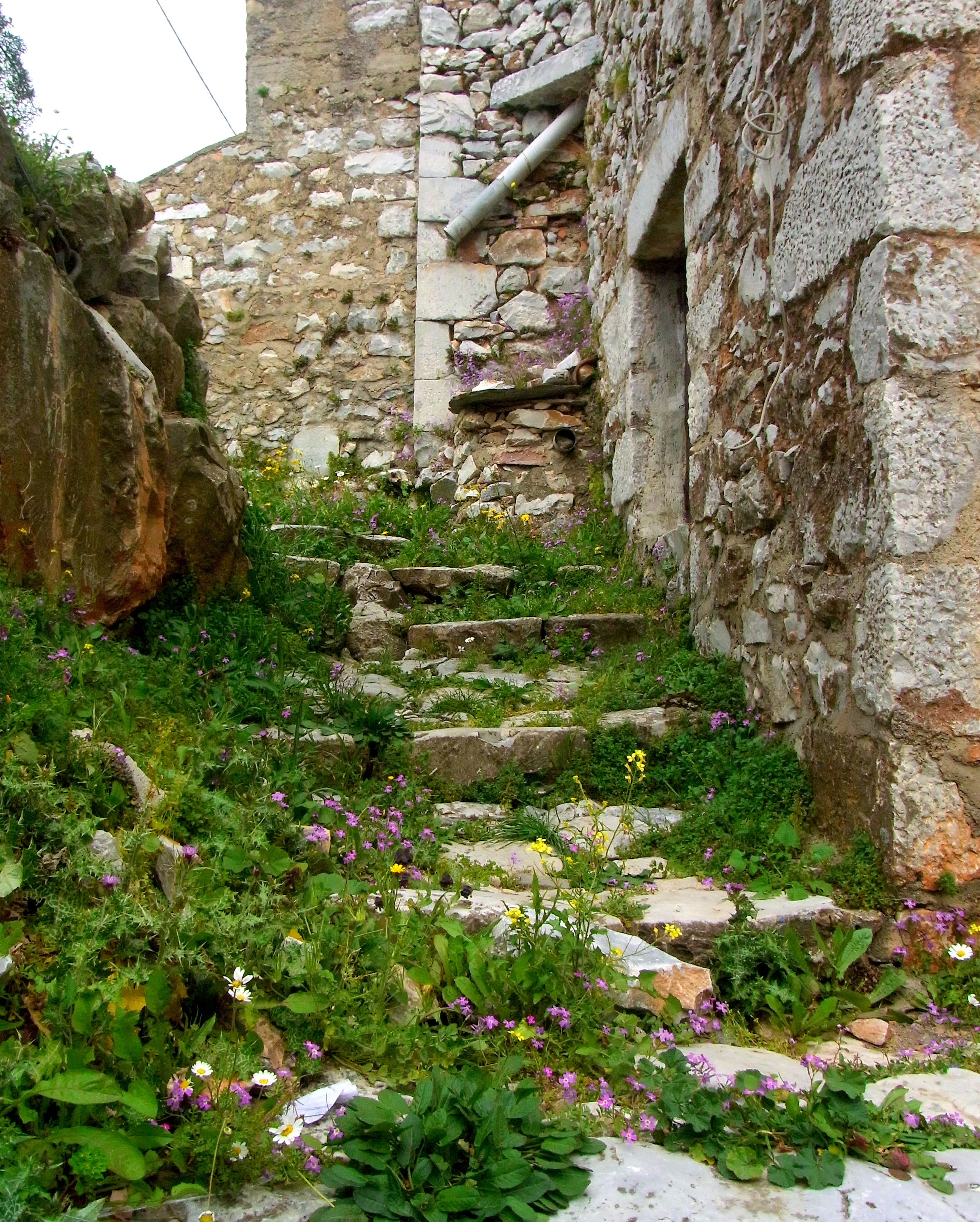
The government provided the village funds to rebuild, and the villagers decided to move the village out of harm’s way, down to the valley floor.  Remnants of the old village can still be seen on the mountain side.  This old house is now used as an animal pen.

P1040131

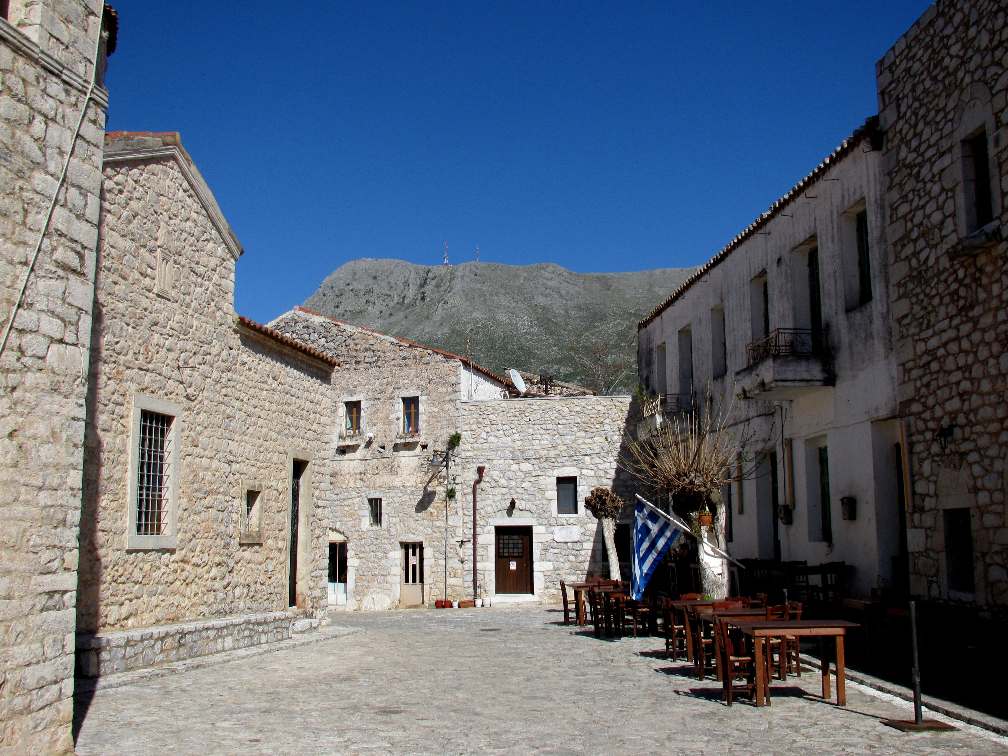
New arrivals in Mariolata, including Sue’s cousin, have built up on the mountainside but well clear of the gorge that flooded.  The upper part of the village includes this pretty plateia and the church of the nativity of Mary.  That feast day is September 8, and Sue’s cousin tells us the entire village treks up the mountainside to participate in the celebration.

P1040178

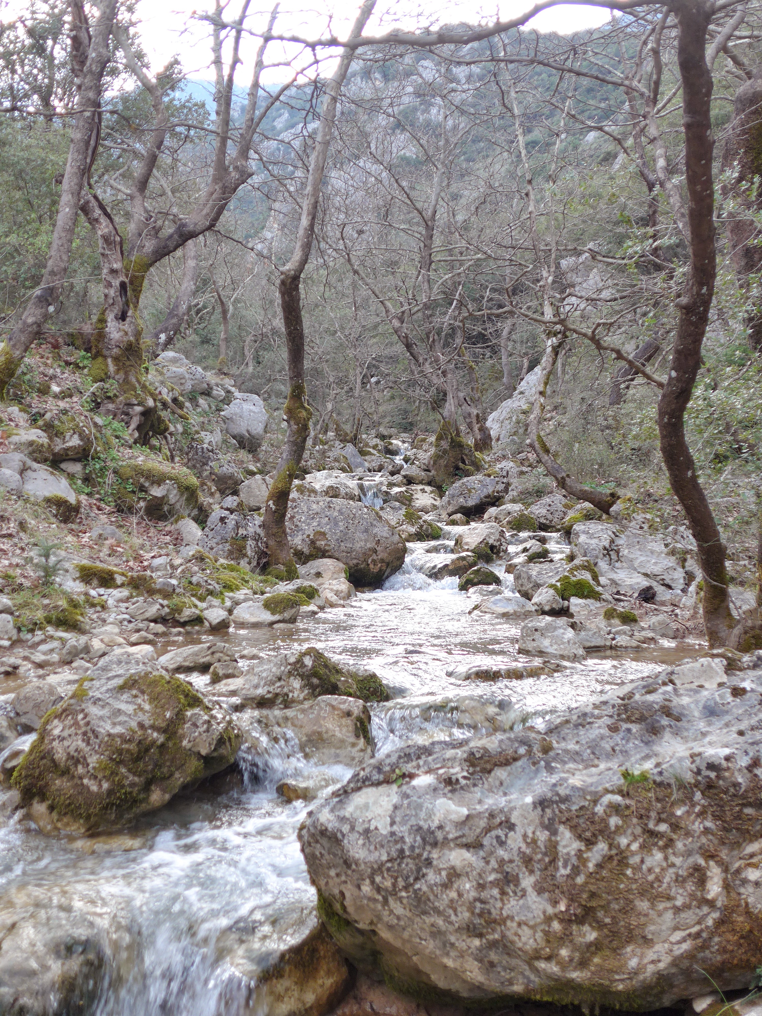
One of the great joys of visiting the village is taking advantage of the opportunities it offers to walk in the countryside.

P1040177

This nice gate encloses a vacant lot, the house, I suppose, having been relocated below.

P1040175

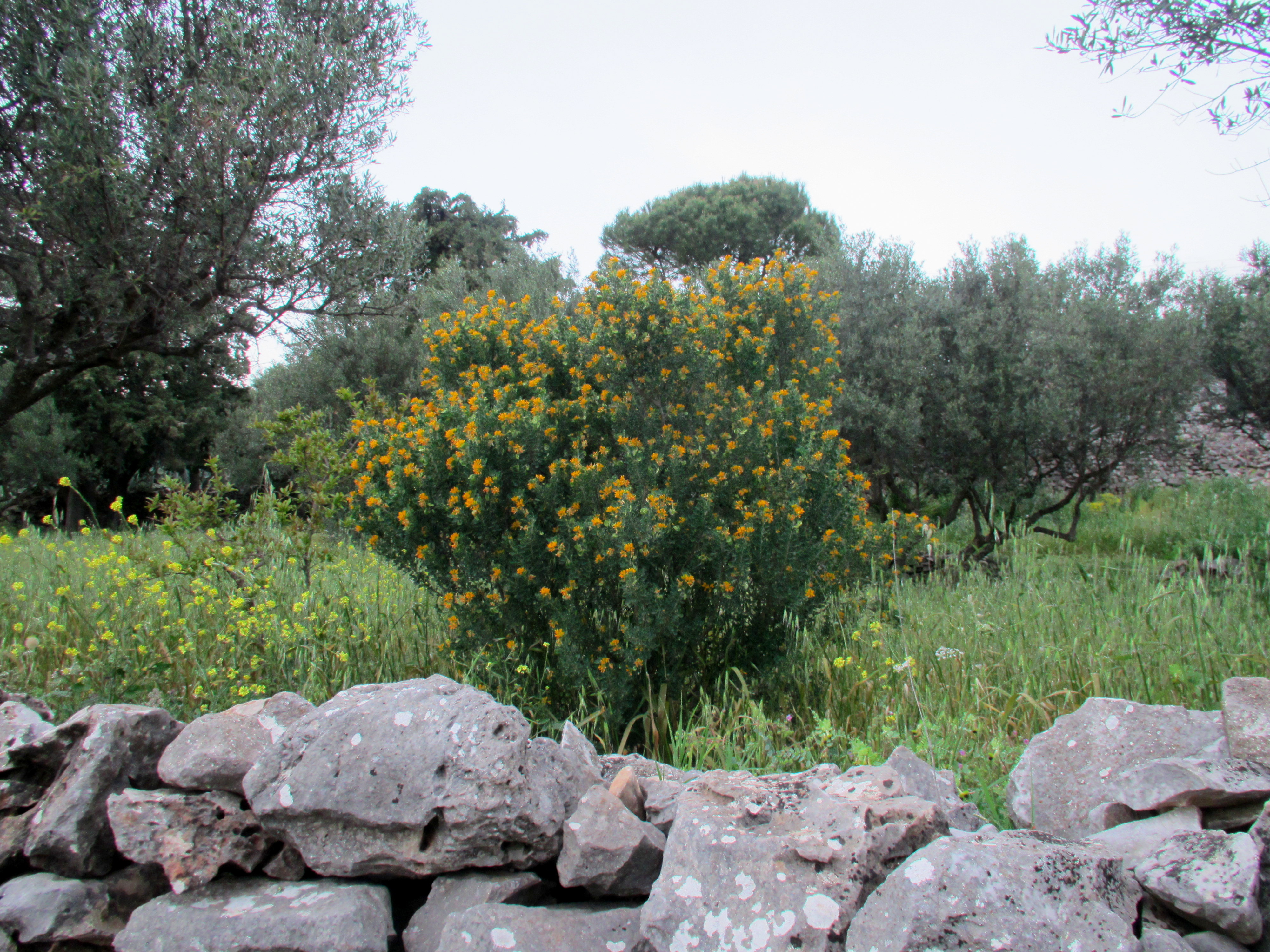
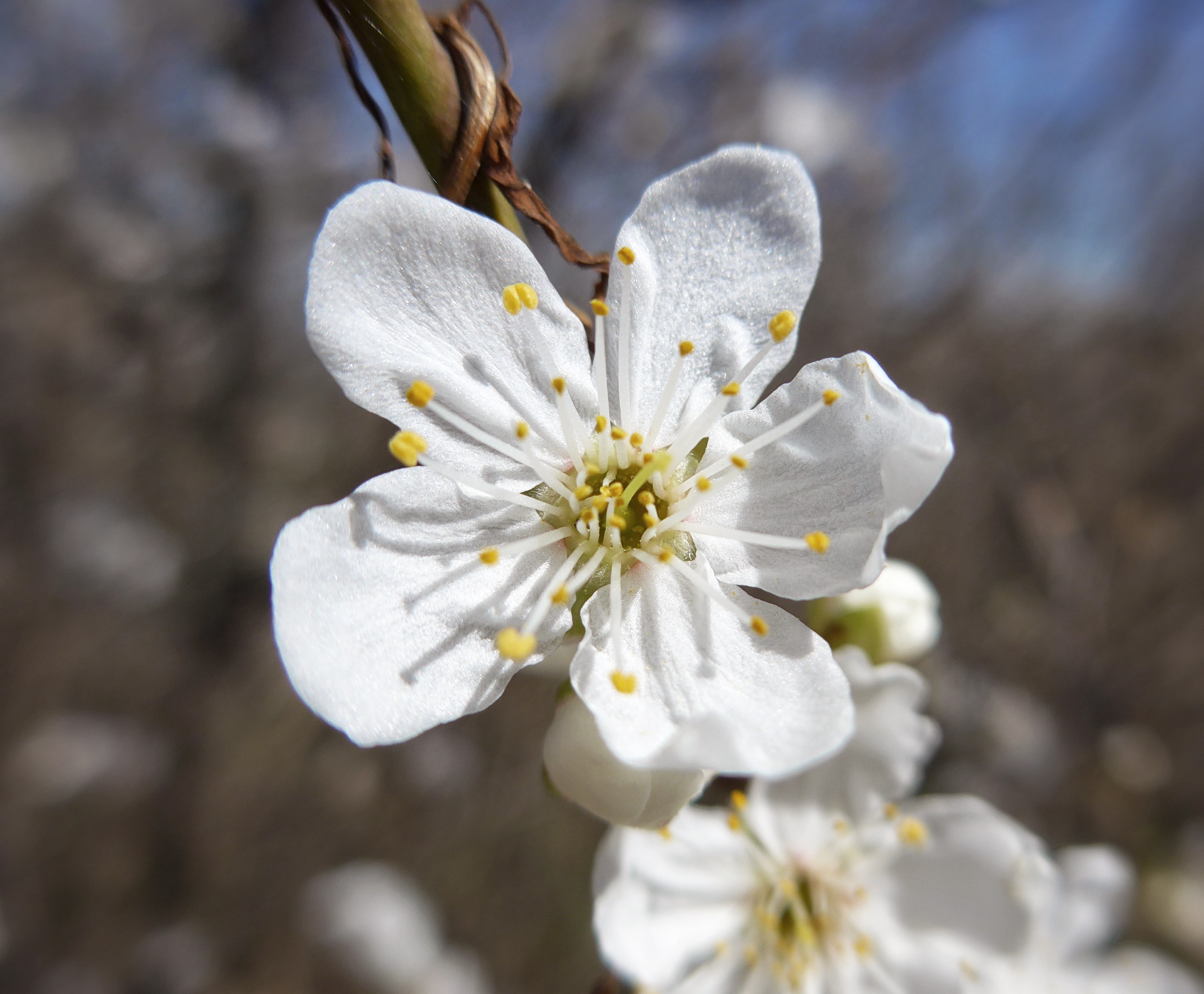
Spring was just beginning when we visited Mariolata, and there were wildflowers blooming all along the roads and footpaths.  We were especially happy to see the almond trees blooming.

P1040161

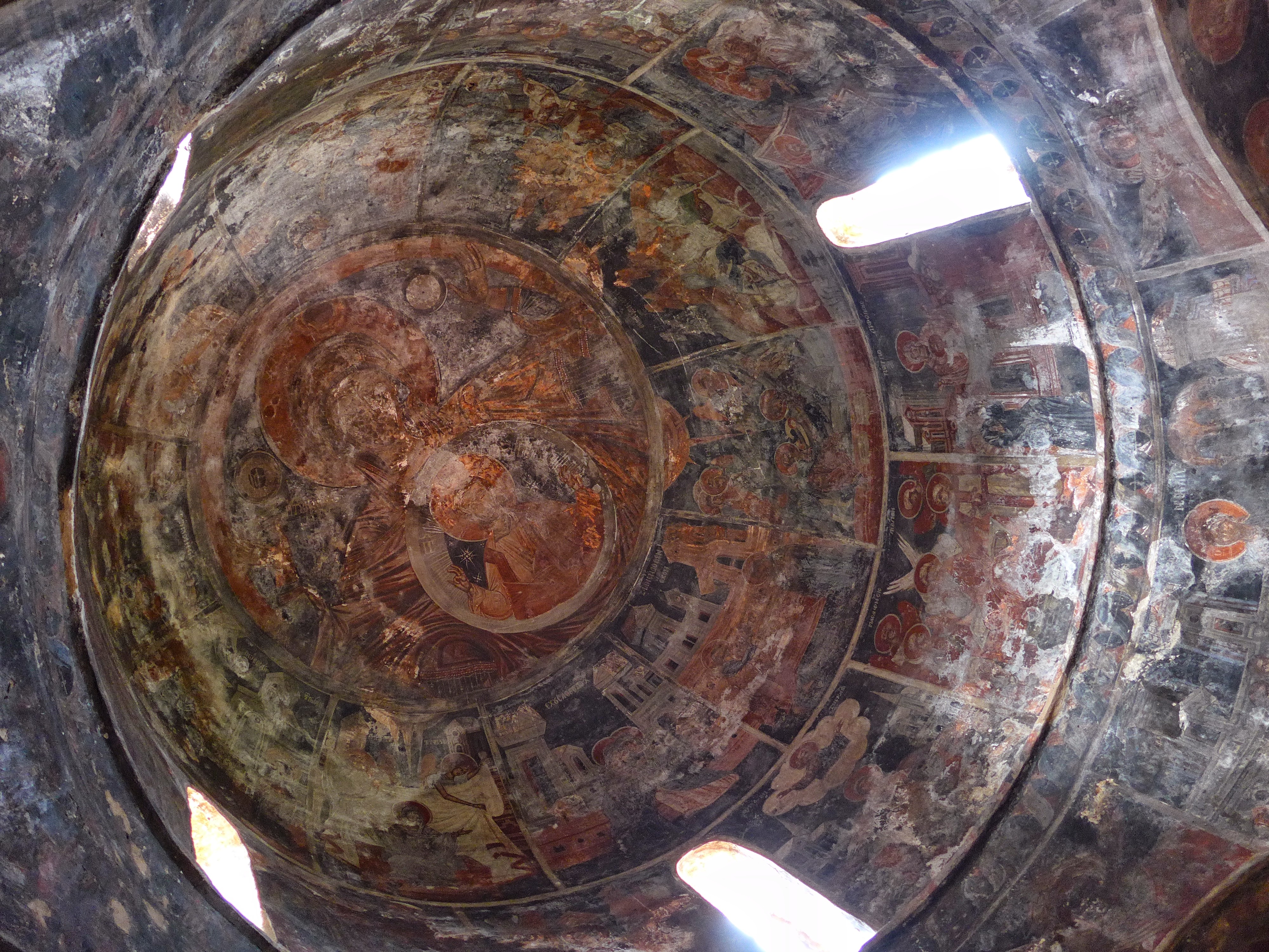
Sue’s cousin took us to an abandoned monastery, high up the mountain on a forestry road (I’d estimate the altitude at about 700 meters).  The monastery’s church, dedicated to Mary “Queen of All” (Pantanasa), dates to the 15th century.

P1040191


The interior is completely covered with period frescoes, which were badly damaged in 1942 when occupying Italian troops shamefully set the church ablaze.

P1040185

The church is unusual in that it features two domes.  At first it appears that the church was built in two phases but indeed it was intended to have double domes from inception.  In this photo, the lower dome’s central fresco depicts Mary Pantanasa and the other dome, above the nave, depicts Christ Pantocrator, the usual subject of orthodox domes.

P1040184

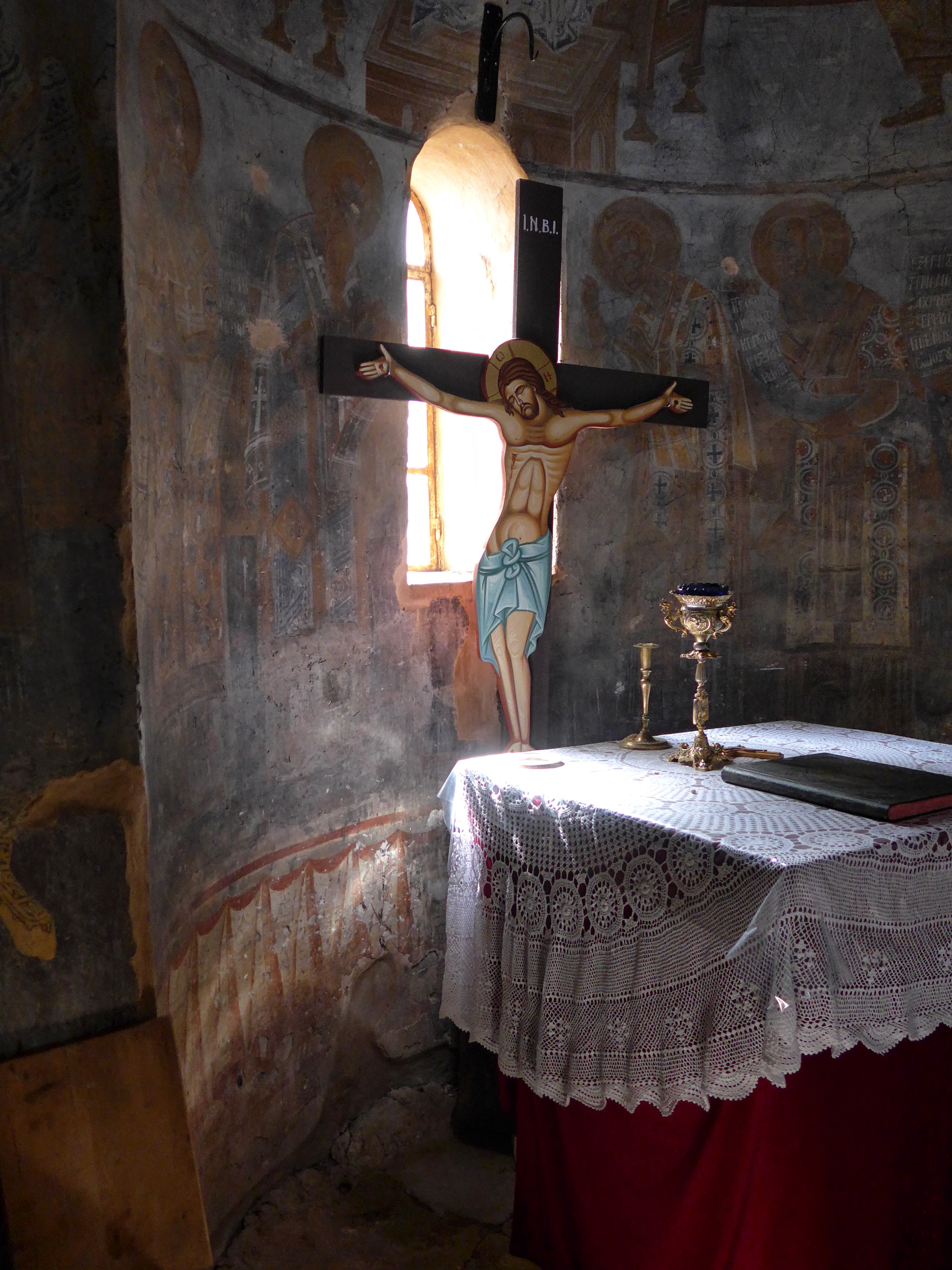
I peeked through the open door of the iconostasis, and found sunlight streaking through the slit window in the sanctuary.

P1040180

There was no snow at the elevations we visited although plenty was visible along the summits and high ridges of Parnassos, and meltwater was streaming down the mountainside everywhere.  One night the temperature dropped to freezing, reminding us that snowfall is a regular feature of winter in the village.

Mariolata is one of a string of 4 villages along the road that skirts the big mountain on its northern flank.  Sue’s cousin showed us all of them, each prettier than the next, and gave us the opportunity to sample the region’s food and wine as well.  It was the ideal way to say farewell to winter while spending precious time with our family.

Unknown's avatar

Oinorama at the Zappeion

IMG_20150307_152354(1)

Every year about this time, we’re preparing to travel to Greece and catching up on the latest Greek news when we read about the just-completed magic that is Oinorama, and it makes us wish we’d booked our flight for just a few weeks earlier so we could have caught it. Well, this year we finally did.  Oinorama is a 3-day wine tasting that features, as near as I can tell, every Greek vintner —  something like 170 wine-makers pouring samples of virtually their entire production.  Saturday and Sunday are open to the public, Monday is trade-only.  We went on Saturday, and it was glorious.  We visited the stands of all of our favorite wine makers, had a chance to see and talk with some of them, and sampled some of the products of vintners that had been recommended by friends or wine writers,  We confirmed our opinions of our favorites, discovered some exciting new offerings by wineries we know well, and found a couple of wineries we’ll have to investigate further.  Great fun, and it gave us new respect for people who do this sort of thing for a living.  The owner of the local wine shop told us he samples at least 70 wines at Oinorama, and the wine staff at Zatinya said they sampled 85 wines a day, three days in a row when touring Greek wine regions.  We tasted, I would guess, 36-40 different wines in a couple of hours, and our palates were dead when we left.  But what a way to kill one’s palate!

Oinorama is held at the Zappeion, a conference and exhibition center in the Public Gardens near the Parliament building and the Panathenaic Stadium.  In was built in 1888 by generous Greek citizens Evangelos and Konstantinos Zappas, and was used as the fencing hall during the first modern Olympics in 1896, as well as the press center during the 2004 Olympiad. We’d visited the Zappeion as a Athens site — the entrance hall and atrium are gorgeous, and a tremendous improvement over any other exhibition hall I’ve seen — but never imagined we’d attend an event there.  The exhibit space is a chain of connected rooms arranged in a semi-circle around the huge circular atrium.  This phone photo was taken in one of the rooms.  The keen-eyed will notice the G’aia stand on the right, and the Ktima Alpha stand across the aisle.  Those are two of our absolute favorites…we spent a lot of time in that room.

IMG_20150307_144029 (1)

Unknown's avatar

Full Moon in Sikya

P1040084

We went out just now to see the first full moon of our time here. We’re used to seeing the moon rise over Mt. Gerania, to the east, so this winter moon rising directly across the Gulf was a sweet surprise.  This is just about where the sun rises in mid-summer.

Not quite visible are the clouds gathering on the horizon.  They are heralding an end to the run of gorgeous weather we’ve enjoyed the last 4 days, and are forecast to bring us cooler, wetter weather through the weekend. Good thing we’re caught up on the laundry.

Unknown's avatar

Καλώς ήρθατε!

P1000519

That’s Greek for “Welcome!” and its literal translation is almost exactly that: “Well (good) to come.”  Our friends and relations have been greeting us that way since we arrived Friday, and last night the first full moon of our stay popped out from behind Mt. Gerania as if to add its own Καλώς ήρθατε!  We didn’t get the lunar eclipse that you lucky folks in North America got to see but the moon here certainly had all the color of a blood moon, and we were thrilled — as always — to see it.


The moonrise capped a sunset walk on the beach, which is now fringed with the wildflowers we love:

P1000493


Mt. Elikonas, the mountain we see from our balcony, capped with clouds  and underlined by an Aleppo pine, whose horizontal growth is a testament to the strong west wind:P1000497


Mt. Parnassos, home of the nine muses.  You can just see that it’s still snowy at the top.  There’s a ski resort on the other (northern) side.

P1000500


Mt. Gerania, from which the moon would soon emerge:

P1000505


The Panagia, freshly painted over the winter, against a backdrop of Melissi village on the left, and our own lovely Sikia on the right:

P1000513


Looking east along the beach at Sikia:

P1000514


And the rest of the moon dance:

P1000522

P1000526
Being welcomed back each year is one of the things we love about Greece but another of Greece’s charms is its customary leaving-taking, “Sto kalo,” which means “Go to the good.”   It’s a simple wish/command that operates on several levels and is emblematic of the love and respect that underlie this culture. Sto kalo.


Unknown's avatar

καλό χειμώνα, Sikya

IMG_6171

Good winter, Sikya.  It’s the standard leave-taking in Greece at summer’s end.  As always, leaving is bittersweet; we’re anxious to see our family and friends in the States but sorry to leave our friends and family in Greece.  The weather this September was spectacular.  From the time we got back to Greece on 26 August until the morning we left (October 3), it was mild and sunny, warm enough for a swim, cool enough to lie on the beach without suffering.  Meals on the balcony have been a delight, and there’s been a very pleasant northwest breeze almost everyday.

The Sikya fleet maintained at least a shadow presence until the last day — a first for us.  And anglers were particularly active this September — both from the beach and in boats in the cove the activity seemed frenetic.  Our peeks at the catch buckets revealed some very nice panfish, a sea-change from the little gavros we usually see reeled ashore.  Adonis was his usual steady self, working out ceaselessly on the beach and in the sea but he, too, is different this year.  With his hair cropped short, and his beard grown out, he’s scarcely recognizable.  Susan said, “It’s like he’s had a head transplant.  I had to look at his body to make sure it was him.” Perhaps he’d take some consolation in that.  And the comedy show we refer to as The Mayor also saw a new act.  When we returned from our trip to Thessaloniki in mid September, the mayor’s boat, know to us as The Scow, was beached in the crook of the cove.  We thought perhaps the mayor had made a desperate miscalculation in attempting to save a few euros on winter docking fees.  Surely the surf would pound that part of the cove all the way to the seawall during winter storms.  But, indeed, The Scow was floating again a couple of days later, albeit a bit lower in the water.  And finally, during the last weekend, we saw a fishing boat giving The Scow a brisk tow in the general direction of the Xylokastro marina.  The mayor’s beach outpost, which grew to gypsy camp splendor this year, took on a decidedly neglected aspect, and the mayor could be spied sitting among the ruins staring disconsolately out to the spot in the cove where The Scow had formerly been moored.

The splendid, dreamy, ideal weather appeared to be coming to an end, however;  the rains had begun.  In the wee hours of 1 October we got a downpour which I estimated at an inch — the most rainfall we’ve witnessed in Greece.  By dawn, however, the sky was cobalt once again and a line of clouds drifted below the top of Mt. Elikonas, across the Gulf.  And the morning we left, in the dark of 4-blinking-30 AM, in a rented Suzuki SX4, I had my first opportunity in 6 months to drive in the rain on our way to the airport.

The last full moon of this year’s trip was while we were visiting Thessaloniki.  It was wonderful seeing it rise over the city but we missed sitting on the beach in Sikya, peering to the east every few seconds, until suddenly, finally, it’s there: larger and closer than we’d expected.

It feels like it’s time to leave.  Our apartment complex is virtually empty, and we’ve wished a good winter to many of our neighbors.  The plateia, so busy on summer evenings, saw only a few kids each night the last 4 weeks, and recently dwindled to none.  The silence, so fervently longed-for, now seems lonely.  We laid in bed this morning, waiting for the 3:00 am alarm, listening to the surf bursting on the beach (a rare treat), thinking of the changing seasons, of time passing irredeemably.  Time to get up and go.  Good winter, Sikia.

Unknown's avatar

Santorini: The Caldera

My impression is that when Americans think about Greece, the visuals that spring to mind are of the Acropolis and the islands.  (At least that’s how it was before the financial crisis.  Now I guess a news photo of some sort of chaos is included in the slideshow.)  And, when it comes to the Greek islands, the usual images are of the clubs on Mykonos and the caldera at Santorini.  I like to post about Greece from the perspective of an American living in an area relatively few foreign tourists visit but we’ve been to Santorini three times in the last 10 months, and it’s been suggested that I post something about this most touristy of all Greek islands.  Since I can’t think of a way to approach Santorini in a single post, I’ll put up several installments in the coming days (I hope), each dealing with an element of the unique experience that is Santorini.

And I’ll start with the blockbuster.  Santorini’s raison d’etre.  The feature that draws the hoards.  That which makes Santorini unique among Greek islands.  The caldera.

IMG_4961

In about 1700 BC, Santorini experienced the mother of all volcanic explosions, a blast that left a ring of three islands on the periphery of a gigantic caldera.  The biggest of the three islands, shaped like a backwards “C,” is Santorini.  Even standing on the rim it’s hard to get a feel for the enormity of the caldera but it’s about 7.5 miles on the north-south axis and 4.3 miles east to west.   The high point of the rim, the village of Imerovigli, near the center of this photo, is 300 meters above the sea.  The overwhelming majority of visitors to the caldera come to Santorini but a smaller island on the other side, Therasia, is also inhabited and welcomes day-trippers mostly.   In addition, two small islets in the center of the caldera have risen from the depths since the big bang 3700 years ago.  The volcano is still active, and dozens of boats daily take tourists out to Nea Kameni to see the volcano and swim in the adjacent hot water.

The photo above was taken from near the center of the backwards “C”, looking north.  That which looks like frosting on the top of the rim are the clustered houses of the villages that line the caldera. The northernmost village, barely visible atop the arm stretching to the left, is Oia, the most famous and most visited spot on the island.

IMG_4976

This is what makes Oia famous and infamous.  The exquisite beauty of the little whitewashed house against the deep blue sea far below.  And the hoards of motor coach and cruise boat tourists that squeeze themselves into the tiny village daily, usually traipsing after a cosmically bored tour guide who stops every minute or two to rattle off the memorized script in all the languages of the UN.  That viewpoint where they’re all standing or waiting to stand is the foundation of a cathedral that went careening into the sea during a terrible earthquake in 1956.  It’s the westernmost point of the island, and a dead-end, so once you’ve shot your selfie there you have to turn around and fight your way back through the throngs.

Looking to the southeast along the caldera from Oia.

IMG_5128

Looking northwest over Oia.  The cliffs beyond are the island Therasia.

IMG_5129

The locals use donkeys to haul tourists up and down the caldera steps.  There are also a couple of roads and a couple of cable cars from the ports.

IMG_4986

IMG_4988

A few more photos from Oia:

IMG_3262

IMG_3266

IMG_3267

IMG_3273

IMG_3294

How to handle the hoards:

IMG_3292

The lighthouse at the opposite end of Santorini from Oia:

IMG_5252

Unknown's avatar

Suddenly, it’s summer

Suddenly, it's summer

Peter Economides (http://petereconomides.com) posted this image this morning under the heading, “Just because it feels like summer today,” perfectly capturing our joy in the day, the warm breeze, and the glorious sea. Economides got our attention with this talk (https://www.youtube.com/watch?v=Chhn5oEmITs) about rebranding Greece which resonated with many people thinking about ways to respond to the current crisis .

In the last week, we’ve gone from highs of around 70 to highs of around 80, and the lingering clouds have been banished. Wednesday is May Day, a holiday, and Sunday is Pascha, and the mood here is Opa!

In addition, while we were sitting on the balcony getting our eyes open this morning, Susan spotted a pod of dolphins swimming west in the Gulf. There were 6 of them, beautiful to watch, and we took it as a sure sign of good times ahead.   Good-bye socks, farewell jeans, hello shorts, yiasou sandals!

Unknown's avatar

A Trip to the Mani

The Mani is the southernmost peninsula in the southernmost part of Greece.  It’s a stark, barren landscape of rock, sea, and sky and it is renowned throughout Greece for its harsh geography and fierce  inhabitants.  It’s also the home of Susan’s forebears, so we have a special affinity for the place.  We particularly like to visit in the early Spring when wildflowers pop from between the rocks and the gray, ashen hills are transformed into a vista one might expect to see in Ireland.  We drove down for a visit at the end of March, and put up at a sweet B&B in Areopoli.

Areopoli is the unofficial capital of the Mani.  Its name, city of Ares (the  god of war), refers to the city’s place as the starting point of the war of independence. On March 17, 1821, independence was declared in the square of the church of the Archangels in the center of Areopoli, and the Maniots immediately marched on the Ottoman garrison in Kalamata.  That garrison fell on March 23, and other parts of Greece joined the fight on March 25, now celebrated as Independence Day.  In the photo below, the view is down the main street of Areopoli, to the bell tower of the church of the Archangels.

IMG_4131

The bell tower:

IMG_4132

Looking back from beside the church to a peak called Arkoutholatsa (815 meters), which guards the city on the east:

IMG_4133

That night the full moon rose over that same peak:

IMG_4152

The next morning we drove north to visit the villages of Stoupa and Kardamyli, and buy some olive oil, sea salt, mountain tea, and other essentials that are just better in the Mani.  We stopped along the road to grab a couple of snaps of the wildflowers:

IMG_4156

IMG_4157

The following morning, we drove south from Areopoli, heading down the eastern side of the peninsula.  Villages in the Mani tend to be sited either deep in valleys or up on ridges or hills.  I suspect the choice had to do with the perception of relative safety at the time the village was founded.   I believe this one is called Olimbies.

Exif_JPEG_PICTURE

This one is Spira, with the Gulf of Laconia beyond.

Exif_JPEG_PICTURE

Those 2 photos were taken from the village of Dimaristika which was once the center for Sue’s family.  This is the family’s war tower in Dimaristika:

Exif_JPEG_PICTURE

Looking back on Dimaristika from Lagia:

Exif_JPEG_PICTURE

We spent some time walking around Lagia, a pretty village where Sue’s great uncle went to school.  This is a nice example of a war tower, probably an early restoration:

Exif_JPEG_PICTURE

The archetypal Mani house, looks to be another older restoration:

Exif_JPEG_PICTURE

There was a large house next to the central church, which we took to be the rectory.  The next 3 photos were taken around that house.

Exif_JPEG_PICTURE

Exif_JPEG_PICTURE

Exif_JPEG_PICTURE

Looking back on Lagia:

Exif_JPEG_PICTURE

This is Porto Kayio, taken from the Venetian for “Bay of Quails”.  In the before times, quail were present in great numbers and they were netted and packed in salt for export.  It was here that we crossed the Mani peninsula to the western side and turned north for Areopoli.

Exif_JPEG_PICTURE

This is a church called Episkopi (12th century),  with the Tigani peninsula jutting into the Gulf of Messinia in the background.  We used a nearly identical photo for our Christmas card a few years back.

Exif_JPEG_PICTURE

A closer look at Tigani.  A Venetian or Frankish fortress was built on the raised portion at the end, guarded by 100 ft cliffs.  Foundations are all that’s left.

Exif_JPEG_PICTURE

While we were driving around looking for the road to Tigani, I grabbed this photo of Susan between two tower houses.

Exif_JPEG_PICTURE

A bit further up the coast, we stopped at the church of St. Barbara (1150 AD), near Erimos.  We’ve also used a photo – different angle – of this church for our Christmas card.

Exif_JPEG_PICTURE

This is an obviously ruined, presumably older church, in front of St. Barbara’s.  You can just make out some fresoes in the vault of the apse.  This is not a unique case in the Mani.

Exif_JPEG_PICTURE

Arriving back at the B&B, we took a walk in the fading daylight and I grabbed this snap of Omales, the  little settlement about a half-mile outside of Areopoli where we stayed.

IMG_4174

A lane in the Mani:

IMG_4165

Peeking into an olive groove in the gloaming:

IMG_4167

The light’s about gone but the tree’s still in bud, and the wildflowers run riot:

IMG_4176

We call this type of cactus a Mani Fig because the Maniots peel and eat the prickly fruit they bear.  This photo doesn’t give an adequate idea of the scale of these plants but standing along side them, they tower over me.

IMG_4171

From the patio of our room I grabbed this shot of the ruined house beyond.  The houses in Omales are slowly being restored.

IMG_4160

As I was taking that last photo this little guy flew out of the house and perched on that ruined wall attached to the center of the house.  It’s known as a Little Owl but we call it a Mani Owl because it’s the only place we’ve seen it.  And we’ve seen or heard it each time we’ve stayed at this B&B.  They’re only 9 – 11 inches tall and are indigenous to southern Europe and Asia.  It appears on all Euro coins minted in Greece.

IMG_4161

Unknown's avatar

Aahhh…

IMG_4094

It’s sort of like waking up.  Or falling into a dream.  Or breaking the water’s surface and finding oneself in another world.  Or floating up from the depths and breaking into fresh, clear air.  That’s how it is.  Transiting the birth canal.  Getting in one of those giant cigar tubes with wings and getting out in not just another country but another world.  And here we are.  Aahhh…

It’s not just the flora and fauna, although they are quite different from what I know of the US.  And it’s not just the geography, although it’s the size of Alabama with more coastline than the entire US, 2500 islands, and the majority of the population living within sight of the sea.  And it’s not just the climate, which is extraordinarily temperate 10 months of the year — July and August  are the exceptions.  And it’s not just the food …I shouldn’t get started about the food.

It’s the people who make this a special place, welcoming, warm, generous, easy to be with.  I don’t know what it is exactly but it seems to stem from their deep connection to this place.  It’s as if they’re living in their great, great, great, great, great, great, etc. grandparents’ house.  They’ve always lived here, they know all there is to know about living here, they’re made up of these minerals, these waters, this sunlight, shaped by the climate and geography. They belong to the place. All of their neighbors do, too.  They are comfortable in themselves and in their land to an extent that we, with the possible exception of the indians, don’t know.

I think that easy way of being is a part of what makes it so pleasant to be here. The emphasis is on living life fully, on feeling life’s pains and pleasures completely, on the preeminence of family, on celebrating the good times and mourning the bad times.  Other issues take their place down the list.

Even now, with the country suffering through a deep economic depression from which it looks to be a long, slow slog to recovery, the spirit of Greece is irrepressible and effervescent.  (There’s an interesting comparison of Greece’s current depression and the US Great Depression here: Seen From Greece, Great Depression Looks Good .) Pensions have been cut in half, college graduates work in supermarkets for the equivalent of $7200/year, medicines and medical technology are in short supply, shopping streets are gap-toothed with closed stores, unfinished highways and railroads rust and grow weeds but…but the smiles are still quick and genuine,  families and friends still gather at every opportunity, and the Greeks remain possibly the world’s most welcoming, generous, and cheerful hosts.

Is that why it just feels good to be here?  Maybe it’s watching clouds scythe across the mountains, maybe it’s learning the moods of the sea, maybe it’s finding fields of wildflowers, orchards speckled with lemons,  poppies along the railroad tracks, wine from grapes called assyrtiko and agiorgitiko, produce from farms just over there…maybe, maybe.  But I think it’s because the Greeks have their priorities organized around what really matters, and because the sense of peace that comes from knowing the important stuff is well looked after infuses every aspect of life.  At least that’s what I think… peace, calm, happiness, love.  The world turned upside up.  Aahhh….


Unknown's avatar

Rain

Rain

At last, rain. Blessed rain. Quenching rain. Cool Rain. Long awaited, wished-for, dreamt-of, fantasized-about rain. Yesterday, a rotating system departed Italy’s boot heel and ventured across the Ionian Sea to Greece’s west coast. We had intermittent showers and a lightshow in the clouds. Our morning running ended in rain, and we invented excuses to go back outside to experience cool, wet air and cool, cool rain on our skin. Today, it rained all day. Complete cloud cover, rumbles of thunder, occasional gusts from the west, the temps drifting from the low 70s in the morning to mid 60s at sunset.

After the months of unblinking sun and flesh-melting heat, today’s weather seems weird. What would be a perfectly normal, if not mild, rainy day in the Mid-Atlantic is rendered fantastic, a psychedelic side-effect of having had our brains boiled daily from mid-June. The clouds traveling across the mountains before us blend their shades of gray with the sea, raindrops on the canopy leave us thinking of rainy nights in a tent, and we are absolved of having to do anything except enjoy it.

The Greek word for summer translates literally to “Good Weather.” I suspect this term originates back in the days when ships were propelled by ranks of oarsmen, and the unspoken suffix to “Good Weather” was “- for sailing.” Once the autumn winds began, a galley was at the mercy of the sea and could well find itself blown across the Mediterranean, like Odysseus. Wise seamen and admirals knew well that pushing the limits of the summer season was courting disaster. What I find a bit disconcerting is hearing Greeks at the end of August taking leave of each with the words, “Good Winter,” as if there are but two seasons, good weather and winter. Of course, there are Greek words for spring and fall, so I think the distinction is more likely between “Holiday season” and “Work/School season” than between “Summer” and “Winter.” It’s a state of mind, not meteorology. Maybe it’s because we’re wrapping up our fifth summer here but it makes perfect sense to me. Until we meet again at the water’s edge, it’s winter.